Things to do in Dana Point: Harbor, Headlands and Surf
A plain guide to Dana Point's harbor, state beach, bluff trails and ocean education, for visitors and neighbors alike.
8 Oct 2026
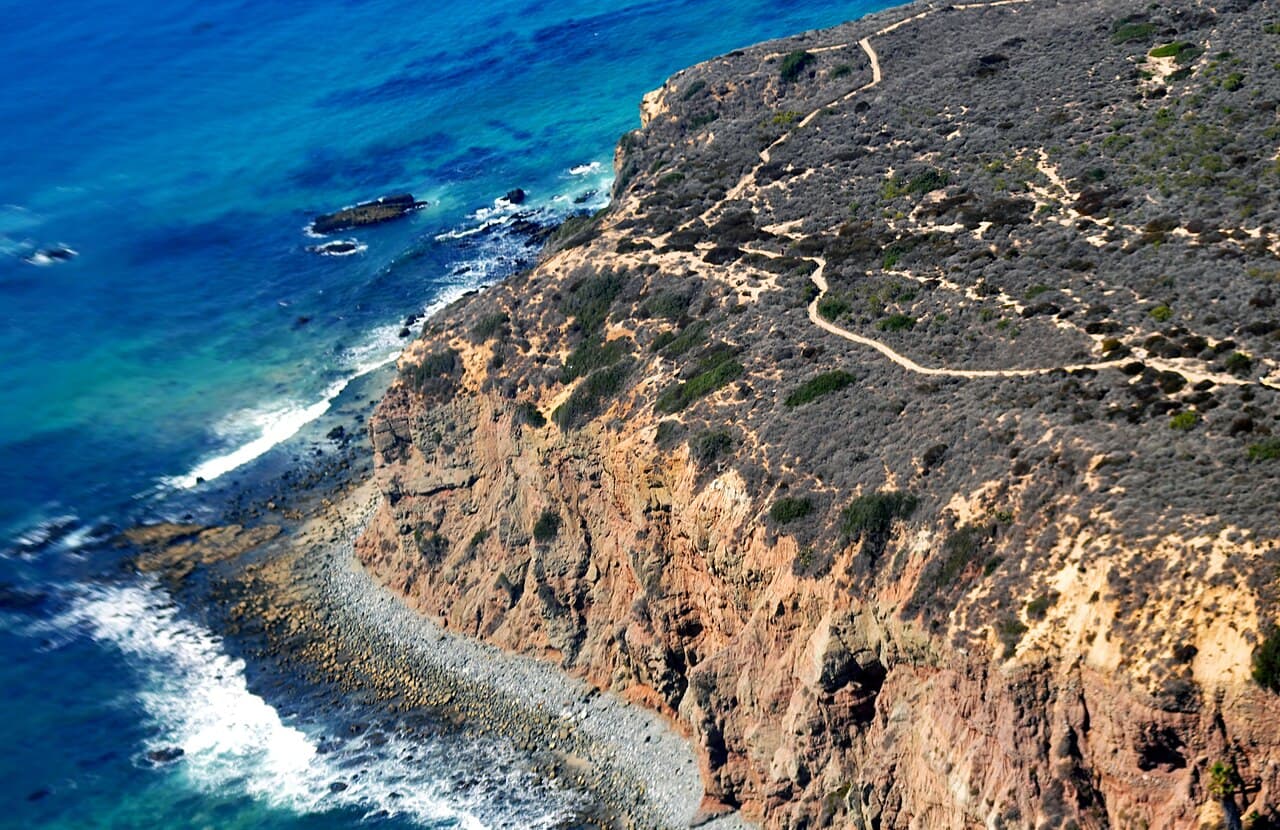
Dana Point sits on the southern Orange County coast. It is named for Richard Henry Dana Jr., who wrote the 1840 memoir Two Years Before the Mast. He called this stretch of shore the only romantic spot on the coast, and plenty of people still agree with him.
The city is small, with a bit under seven square miles in total. Most of what draws people here is close to the water, so you can see a lot in a day or two. This guide sticks to places that have been here for years and are likely to stay.
Beaches and the harbor
Doheny State Beach is the main beach in town. An oil businessman named Edward Doheny once owned the land, and it was given for public use in 1931, which made it California's first state beach. About one million people visit in a year.
The north end is known for surfing, and there are volleyball courts, a five acre lawn and picnic spots. The south end has a campground and a visitor center. Inside the center you will find aquariums and a tide pool display, plus a paved trail along the beach for walking, biking and skating. Dogs are not allowed on the sand or in the water, but leashed dogs can use the trail and the parking areas.
Dana Point Harbor was built in the 1960s and dedicated in 1971. It has a marina, a promenade, shops and paths that wind between small islands of landscaping. It is also the place where the ferry to Catalina Island departs. Even if you do not plan a boat trip, it is a pleasant spot for a slow walk and a look at the boats.
The Strands, below the bluffs, is another public way down to the sand. It has stairs, restrooms and a sidewalk along the beach.
Bluffs, trails and the Headlands
The Dana Point Headlands is a protected area on the bluffs above the harbor. It is made up of four parks: Harbor Point Conservation Park, Dana Point Preserve, Hilltop Conservation Park and South Strands Conservation Park. A public trail system of about three miles links them. Along the way you pass scenic overlooks and spots with coastal access.
The Headlands protect native coastal plants, including coastal bluff scrub, native grasses and coastal sage scrub. More than 150 native kinds of plants and animals live here. Birdwatchers may look for the coastal California gnatcatcher, a small bird that is protected by federal law.
Dana Point Preserve is the easy one. It is a half mile dirt path along the bluff, with benches and wide views over the water. Stay on the marked path, because the cliff edges can give way.
The Nature Interpretive Center sits at the head of this trail system. It is a good first stop if you want to know what you are looking at. The area also has deep roots in Acjachemen history. An Acjachemen village called Toovannga once stood near what is now the harbor.
For families
The Ocean Institute is in the harbor, on about two and a half acres. It is a nonprofit that began in 1977 and teaches marine science and maritime history. Its fleet includes the research boat Sea Explorer. On land, a 4,000 gallon shark touch tank lets kids see sea life up close. There is also a Maritime Barn and History Center with hands on stations.
Whale watching is another easy family outing from the harbor. Trips run through the year. Blue whales are usually seen from about May to October, and gray whales pass by from about November to April.
Back at Doheny, the visitor center aquariums and the tide pool are good stops for small children. Younger kids can also run around on the big lawn.
When it rains
Dana Point gets about 12 inches of rain in a year, and most of it falls between November and March. August is the warmest month, with highs around 79 degrees Fahrenheit, and December is the coolest, with highs around 65.
On a wet day, head indoors. The visitor center aquariums at Doheny and the exhibits at the Ocean Institute are the two places to start. Check with the city before heading out to the bluff trails after a storm.
Getting around
The harbor, the Lantern District and the paths nearby are friendly to walkers and cyclists. There are dedicated walking and bike paths in the harbor and downtown area.
In summer, a trolley loops through town, linking the resorts, the harbor and the downtown plazas. It runs from about Memorial Day to Labor Day. Ride-hailing apps also work here.
Good to know
The ocean is cool most of the year. Pack a layer, even on a sunny day.
Dogs are not allowed on Doheny's sand or in its water.
No dogs are allowed on the Headlands trails.
Stay on the marked trails at the Headlands. The bluffs are fragile.
Seasons matter for whale watching. Check which whales are passing before you book.
Check each park's own website for current trail and facility status before you go.
Find local businesses
Planning a visit, or live nearby and need a hand with something? Browse the local businesses listed in the South Orange County guide to find who serves Dana Point and the towns around it.
Useful links
Businesses in Dana Point in the South Orange County guide
About Dana Point: the town at a glance
Own a business in Dana Point? Claim or add your listing, free
By Thomas Hassett and Eric Andrews, Local Business America
Photo: Don Ramey Logan, CC BY-SA 3.0, via Wikimedia Commons.
Sources: Wikivoyage, "Dana Point" (https://en.wikivoyage.org/wiki/Dana_Point); Wikipedia, "Dana Point, California" (https://en.wikipedia.org/wiki/Dana_Point,_California); California State Parks, "Doheny State Beach" (https://www.parks.ca.gov/doheny); City of Dana Point, "Dana Point Headlands Conservation Area" (https://www.danapoint.org/Community/Dana-Point-Nature-Interpretive-Center/Dana-Point-Headlands-Conservation-Area); City of Dana Point, "Dana Point Preserve" (https://www.danapoint.org/Community/Parks-Trails/Dana-Point-Preserve); Ocean Institute, "About" (https://oceaninstitute.org/about). Wikivoyage and Wikipedia text is available under CC BY-SA.