Things to do in Rancho Santa Margarita: Lakeside Walks and Foothill Parks
A plain guide to Rancho Santa Margarita's lake path, Central Park and the O'Neill park and national forest in the foothills just beyond town.
8 Oct 2026
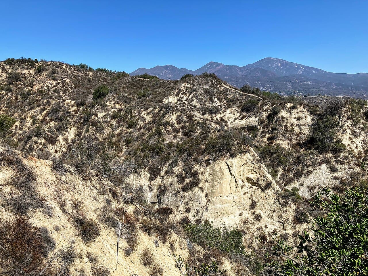
Rancho Santa Margarita is a master-planned city on a high plateau called Plano Trabuco, in the foothills of southern Orange County. The streets, neighborhoods and parks were laid out as one plan, so it feels tidy and calm. The city incorporated in 2000, and the city calls itself a small city with the soul of a village.
The name is a mouthful. At 20 letters, it is the longest city name in California. This is a quiet residential town, and most of its own parks belong to neighborhood associations. So this guide spends part of its time on the wild land just beyond the city limits, where the big trail systems are.
Around town
Central Park is the main community park. It has a dog park, a skate park and a splash pad.
The lake is the other favorite. Rancho Santa Margarita Lake has a path around it that is good for walking, jogging or biking. It is a simple outing for a walk with children or a bike ride.
One thing to know is how the parks work here. The parks are privately owned and kept up by homeowner associations, including the Rancho Santa Margarita Landscape and Recreation Corporation. There are 13 community parks, plus special places such as the dog park, skate park and splash pad. Some amenities may need keyed access, so look at what is open to the public before you plan a visit.
O'Neill Regional Park
For real trails, head to O'Neill Regional Park, run by OC Parks. It covers 4,500 acres and stretches along Trabuco Creek and Live Oak Canyon, in the foothills of the Santa Ana Mountains. It is long and narrow, and about 7.5 miles of Trabuco Creek run through it.
The park began in 1948, when the owners of the O'Neill Ranch gave the first 278 acres for public use. More land was added over the next few decades until it reached its present size.
The scenery is oak and sycamore country. The valley floors are heavily wooded with coast live oak and sycamore trees, while the hillsides carry cactus, wild buckwheat, sagebrush and chaparral. The creeks usually run in winter and early spring. Bobcats live in the park.
More than 23 miles of trails serve hikers, mountain bikers and horse riders. There are picnic areas and barbecue spots, horseshoe pits, turf areas and a children's playground. The park also has an amphitheater and a center for nature programs.
The Arroyo Campground has 79 campsites for tents or RVs, eight large group sites and five sites for horse campers, with corrals.
A very old place
The land here is the ancestral home of the Acjachemen people. A village called Alume stood between Trabuco Creek and Tijeras Creek, and the village site lies inside O'Neill Regional Park today. In 1810 the Trabuco Adobe was built near the village as an outpost of Mission San Juan Capistrano.
Later, the area became part of Rancho Mission Viejo, a very large ranch. The city of Rancho Santa Margarita was built on part of that ranch land.
Trabuco Canyon and the national forest
North of the city is Trabuco Canyon, a small rural community in the foothills that is partly inside the Cleveland National Forest. In the early 1900s people tried to mine tin in the canyon. The miners left behind tunnels and dams on the creek.
The Cleveland National Forest runs along the eastern edge of Rancho Santa Margarita. The forest covers 460,000 acres across San Diego, Riverside and Orange counties. Its Trabuco Ranger District is the northernmost part and covers most of the Santa Ana Mountains. People go there to hike, camp, watch birds, ride horses and mountain bike.
The highest peak in these mountains is Santiago Peak, at 5,689 feet. It is also the highest point in Orange County.
For families
Walk the path around the lake together.
Let kids run at the splash pad in Central Park on a warm day.
Pick a picnic spot at O'Neill Regional Park, where there is a children's playground and plenty of oak and sycamore trees.
Camp for a night at the Arroyo Campground, which has family sites.
Getting around
State Route 241, a toll road, gives the city its freeway link. Santa Margarita Parkway and Antonio Parkway are the two main streets. Alicia Parkway ends in the city and connects it to Mission Viejo, which lies to the west. The city has a Mediterranean climate, with mild, wet winters and warm, dry summers.
Good to know
Most city parks are run by homeowner associations, so check access before you go.
O'Neill Regional Park trails close for three days after rain.
Wildlife lives in the foothill parks, so keep to marked trails.
Check each park's own website for current trail and facility status.
Find local businesses
Planning a visit, or live nearby and need a hand with something? Browse the local businesses listed in the South Orange County guide to find who serves Rancho Santa Margarita and the towns around it.
Useful links
Businesses in Rancho Santa Margarita in the South Orange County guide
About Rancho Santa Margarita: the town at a glance
Own a business in Rancho Santa Margarita? Claim or add your listing, free
By Thomas Hassett and Eric Andrews, Local Business America
Photo: Wasquewhat, CC BY-SA 4.0, via Wikimedia Commons.
Sources: Wikipedia, "Rancho Santa Margarita, California" (https://en.wikipedia.org/wiki/Rancho_Santa_Margarita,_California); Wikipedia, "Trabuco Canyon, California" (https://en.wikipedia.org/wiki/Trabuco_Canyon,_California); Wikipedia, "O'Neill Regional Park" (https://en.wikipedia.org/wiki/O%27Neill_Regional_Park); OC Parks, "O'Neill Regional Park" (https://parks.oc.gov/oneill); City of Rancho Santa Margarita, "Community Parks" (https://www.cityofrsm.org/345/Community-Parks); City of Rancho Santa Margarita, "Visitors" (https://www.cityofrsm.org/415/Visitors); City of Rancho Santa Margarita, "About the City" (https://www.cityofrsm.org/194/About-the-City); Wikipedia, "Cleveland National Forest" (https://en.wikipedia.org/wiki/Cleveland_National_Forest); Wikipedia, "Santiago Peak" (https://en.wikipedia.org/wiki/Santiago_Peak). Wikivoyage has no page for this town, and Wikipedia text is available under CC BY-SA.